UPDATE: Local officials, NWS determining what type of storm hit Cleveland Highway
Published 9:51 am Wednesday, May 24, 2017
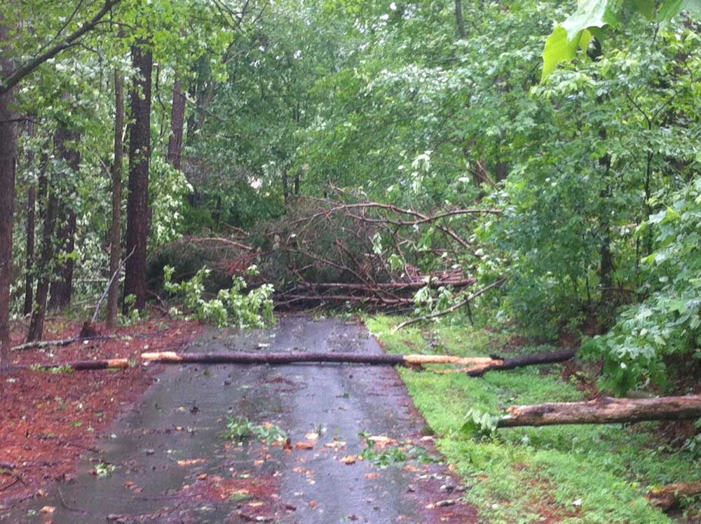
- Chris Whitfield/Daily Citizen-NewsTrees lay across the driveway of a home off Cleveland Highway after a storm raced through the area Wednesday morning.
Whitfield County Emergency Management officials are working with the National Weather Service to determine what type of storm event hit the 2500 block of Cleveland Highway this morning.
Trending
If you have damage reports or pictures, email them to ema@whitfieldcountyga.com.
There has not been confirmation of a tornado on Cleveland Highway this morning, according to Whitfield County EMA.
“Initial reports indicate a tornado may have touched down, but that is NOT confirmed at this time,” according to a press release from Whitfield County EMA. “There are currently no reports of injuries or fatalities.”
Much of north Georgia — including Whitfield and Murray counties — was under a tornado watch this morning. The tornado watch was canceled at about 11:45 this morning, according to the National Weather Service.
Trending
A fast-moving storm raced through the area this morning as a tornado warning that was issued for northeastern Murray County and east central Whitfield County expired at 10:15 a.m. The Whitfield County 911 Center reported “severe winds” and trees down in the Pleasant Grove and Orchard Way area. There was a report of at least one tree falling on a house.
Emergency crews are stationed at the 2500 block of Cleveland Highway, at the shopping center with several businesses including Tractor Supply Co.
If you have been affected by the storm, call 911 to report life-threatening emergencies or (706) 259-3730 to report storm damage.
As of 11:15 a.m., North Georgia EMC reported about 1,000 members without power in Whitfield and Murray counties, mostly from Cleveland Highway west to I-75 and north of the North Bypass. View the live outage map here.
A tornado warning means a tornado has been sighted or indicated by weather radar; a tornado watch means conditions are favorable for a tornado.
The NWS warned of strong storms throughout the day.
“Showers and thunderstorms will increase across north and central Georgia this morning and continue through the afternoon,” according to the NWS. “Some storms could be strong to severe, capable of damaging winds, large hail and even a few tornadoes. In addition, locally heavy rain could result in localized flash flooding. The severe threat will diminish from west to east across the area, this afternoon with widespread showers and thunderstorms across far southeast counties, ending this evening.”
PREVIOUS STORY (9:55 a.m. today)
A tornado warning has been issued for northeastern Murray County and east central Whitfield County until 10:15 this morning, according to the National Weather Service.
At 9:47 a.m. a severe thunderstorm capable of producing a tornado was located over Dawnville moving northeast at 40 mph.
“Flying debris will be dangerous to those caught without shelter,” according to the NWS. “Mobile homes will be damaged or destroyed. Damage to roofs, windows, and vehicles will occur. Tree damage is likely.”
Locations impacted include Dalton, Chatsworth, Eton, Crandall, Conasauga Lake, Tennga, Beaverdale, Dawnville, Sumac, Cisco and Gregory.


-
eEdition
-
-
