‘Go get your milk and bread’: North Georgia braces for possible snow
Published 2:29 pm Friday, January 6, 2017
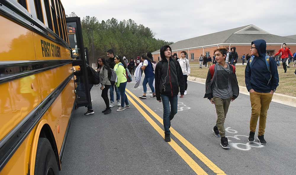
- Students file out of Dalton Middle School Friday during early dismissal due to wintry weather.
DALTON, Ga. — While the Metro Atlanta area is bracing for the chance of several inches of snow today, a National Weather Service meteorologist said the Dalton area shouldn’t be as concerned about snowfall.
Instead, the major concern will be the below-freezing temperatures expected to linger in the area through the weekend and into early next week. The area is under a winter storm warning from today at 1 p.m. through Saturday at 1 p.m.
The threat of wintry weather led Whitfield County Schools and Murray County Schools to close today, while Dalton Public Schools will release students early.
Judy Gilreath, Whitfield County Schools superintendent, decided to close schools today because of the forecast of snow and after discussions with local emergency management officials. She considered a delayed start or an early dismissal, but there is possibility of snow moving in this afternoon.
“I just don’t want having kids on the road,” said Gilreath, who acknowledged she may be criticized for calling off school.
Students in Dalton Public Schools will have an abbreviated day.
“Due to the likelihood of inclement weather (Friday), Dalton Public Schools will dismiss school early,” spokeswoman Pat Holloway said. “Dalton Middle School will release students at 11 a.m. while all elementary and high schools will release students at noon. All students will be served lunch and buses will run their regular routes at that time. After school care will not be open (Friday).”
According to the NWS, there’s a 40 percent chance of snow today mainly after 10 a.m. Skies will remain cloudy, with a high near 32. New snow accumulation of less than one inch is possible. Snow is likely tonight, mainly between 11 p.m. and 3 a.m. The low will be about 21. Chance of precipitation is 60 percent, with new snow accumulation of around an inch possible.
“For your area, maybe two to three inches right now,” NWS meteorologist Sid King said. “That is always subject to change. It looks like you will be out of the area for the heaviest snowfall. In your area, temperatures will stay very cold and might not get above freezing again until Monday. It would only be enough for minor melting, especially in the teens for your lows, so it will be a very prolonged event with difficult travel through the weekend.”
It is the travel concerns that have local officials and emergency responders anxious for the weekend.
“We are prepared and ready to go,” Whitfield County Public Works Director Dewayne Hunt said. “We hope people stay home. Due to the type of precipitation and the temperatures staying low, there will be a lot of slick spots out there — especially on the curves and the bridges. We will do our best to get out and salt the areas we know are going to be trouble spots, but there could be slick spots all over. If it is more icy, it will be very difficult.”
Hunt said if you don’t need to drive today, then don’t.
“If you don’t need to go anywhere, my advice is just don’t,” Hunt said. “Sleet and ice is a tougher problem than snow. If it snows and it really isn’t sticking to the asphalt, when we blade it we get about 95 percent of it off. We don’t feel like we are going to get any help from Mother Nature and it is just going to stay frozen the entire time.”
Gov. Nathan Deal has issued a state of emergency across much of North Georgia (including Murray and Whitfield counties) for Friday, and he ordered the Department of Transportation to start treating major routes with brine late Thursday night. The state of emergency covers 79 counties including metro Atlanta and all of North Georgia.
“Georgians should stay calm, make the appropriate preparations and stay aware of potential change in weather conditions,” Deal said in a statement from his office.
Dewayne Bain, Murray County fire chief and Emergency Management Director, echoed Hunt’s advice and urged residents to stay off the roads once the snow begins.
“We are in a holding pattern right now, and according to the NWS, there may be some things earlier, but they aren’t looking for anything in particular until 1 p.m. or further,” Bain said. “We just got out of a weather briefing, with our county players and we are getting ready for Friday evening.
“Go get your milk and bread,” Bain said when asked what advice he would give local residents. “Right now, if you don’t have to be on the roads, stay off the roads. If it hits there will be come ice accumulation and you will have some initial melting but it will freeze back. Bridges will be bad from the start. The main thing is if you don’t have to be on the road, stay off and have a family weekend at home.”
(Daily Citizen Managing Editor Jamie Jones contributed to this report.)
What should I do to prepare ahead of time?
• Build an emergency kit well in advance: Don’t forget to include critical documents, medications, food, water, blankets and warm clothing for your entire family.
• Winterize your vehicle and keep the gas tank full. A full tank will keep the fuel line from freezing.
Responding and remaining safe during a winter storm
• Stay informed. Listen to a NOAA Weather Radio or other local news channels for critical information on snow storms and blizzards from the National Weather Service (NWS).
• Bring pets/companion animals inside during winter weather. Move other animals or livestock to sheltered areas and make sure that their access to food and water is not blocked by snow drifts, ice or other obstacles.
• Running water, even at a trickle, helps prevent pipes from freezing.
• All fuel-burning equipment should be vented to the outside and kept clear.
• Keep garage doors closed if there are water supply lines in the garage. Open kitchen and bathroom cabinet doors to allow warmer air to circulate around the plumbing. Be sure to move any harmful cleaners and household chemicals up out of the reach of children.
• Keep the thermostat set to the same temperature both during the day and at night. By temporarily suspending the use of lower nighttime temperatures, you may incur a higher heating bill, but you can prevent a much more costly repair job if pipes freeze and burst.
• Go to a designated public shelter if your home loses power or heat during periods of extreme cold.
• Avoid driving when conditions include sleet, freezing rain or drizzle, snow or dense fog. If travel is necessary, keep a disaster supplies kit in your vehicle.
• Before tackling strenuous tasks in cold temperatures, consider your physical condition, the weather factors and the nature of the task. Protect yourself from frostbite and hypothermia by wearing warm, loose-fitting, lightweight clothing in several layers. Stay indoors, if possible.
• Help people who require special assistance such as elderly people living alone, people with disabilities, access or functional needs and children.
• Never use a generator, grill, camp stove or other gasoline, propane, natural gas or charcoal-burning devices inside a home, garage, basement, crawlspace or any partially enclosed area. Locate unit away from doors, windows and vents that could allow carbon monoxide to come indoors. Install carbon monoxide alarms in central locations on every level of your home and outside sleeping areas to provide early warning of accumulating carbon monoxide.
Source: The American Red Cross
-
eEdition
-
-
